IEM Daily Feature
Monday, 10 October 2016
Monday, 10 October 2016
30 Day Departures
Posted: 10 Oct 2016 05:33 AM
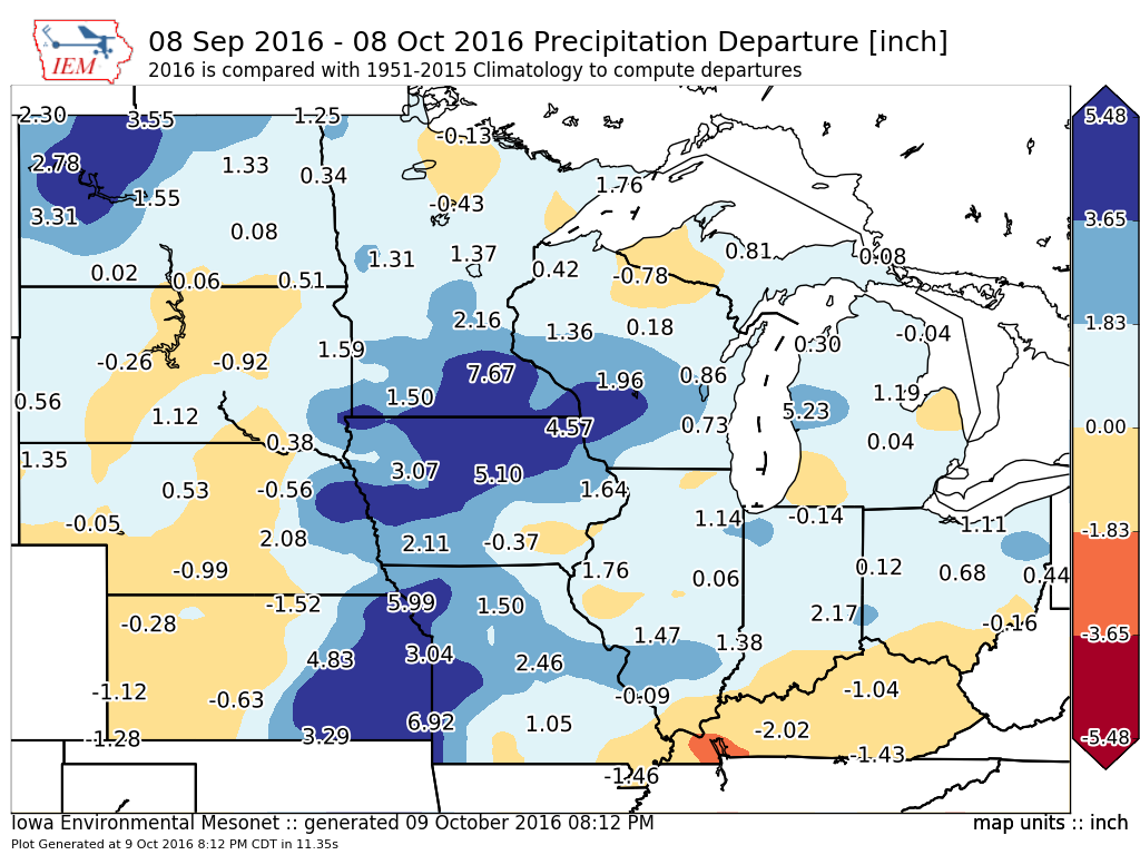
The featured map presents 30 day precipitation departures over the midwestern US based
on NWS COOP reports and RADAR based precipitation estimates. The wettest departures
are analyzed from eastern Kansas up into southwestern Minnesota. Even with such high
departures, on only needs to travel a bit further south to southeastern Iowa to find drier
than average conditions. Precipitation totals over the next seven days look rather meager,
which will be helpful for the crop harvest progression.
Voting:
Good = 9
Bad = 0
Voting:
Good = 9
Bad = 0