IEM Daily Feature
Wednesday, 16 November 2022
Wednesday, 16 November 2022
'22-'23 Winter Storm #2
Posted: 16 Nov 2022 08:38 PM
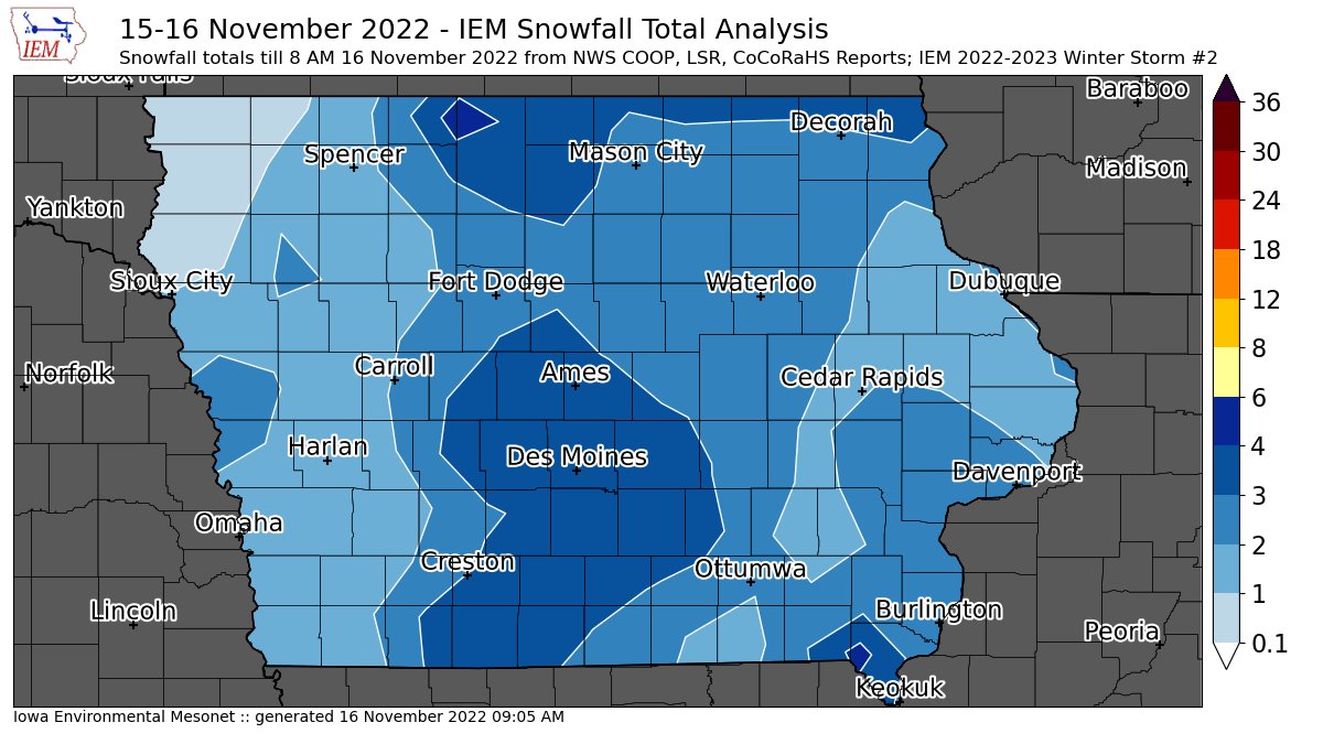
The featured map is an attempt to produce an estimate of snowfall reports from the second snow storm
that impacted Iowa on Tuesday and into Wednesday. There is a major caveat in that some of this snow
over northwestern and northcentral Iowa was likely counted within yesterdays map, since the events
overlapped the typical 24 hour reporting period. Additional snow is also still falling this Wednesday, but
is expected to be very light except over portions of extreme eastern Iowa. While the snow on Tuesday
was not too bad to deal with thanks to warmer temperatures close to freezing, today is a different story
with temperatures well below freezing and a more difficult process to keep roads clear with some
blowing snow happening as well. Regardless of all these caveats, a good chunk of the state received
two to four inches of snow and a full blown taste of winter after temperatures in the 70s just last week!
Voting:
Good = 12
Bad = 1
Tags: winter2223
Voting:
Good = 12
Bad = 1
Tags: winter2223