IEM Daily Feature
Friday, 04 March 2022
Friday, 04 March 2022
March Day 2 Slight Risk
Posted: 04 Mar 2022 05:36 AM
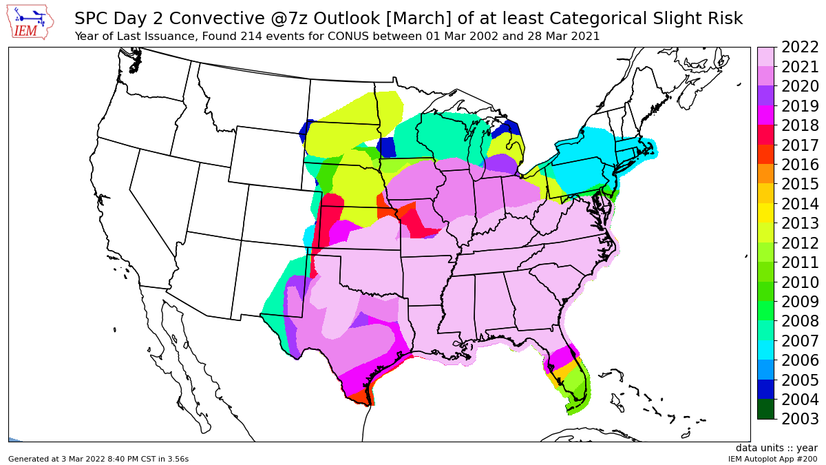
For the past few days, much of Iowa has been under a convective slight risk by the Storm Prediction
Center for Saturday. Prior to this upcoming event, the featured map presents an analysis of the year of
last day 2 slight risk over the CONUS. This analysis is done by rasterizing the outlook polygons to a
grid. For NW Iowa, it has been ten some years since a slight risk (the present day two disk covers
almost all of that area). While this map does not address frequency, the southeastern US is certainly
the most common area for such alerts during March. The storm systems that produce severe weather
typically track SW to NE over the United States, so the northern and western portions are almost
always on the cold side of such systems. The upcoming storm threat on Saturday looks to be mostly
from straight line winds, but a tornado threat is present as well.
Voting:
Good = 19
Bad = 1
Abstain = 2
Voting:
Good = 19
Bad = 1
Abstain = 2