IEM Daily Feature
Wednesday, 29 December 2021
Wednesday, 29 December 2021
'21-'22 Winter Storm #2
Posted: 29 Dec 2021 06:39 AM
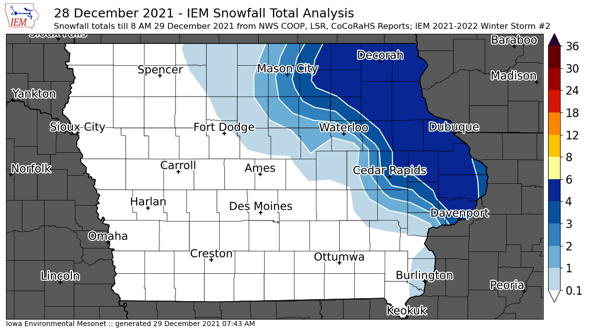
After the tornadoes and thunderstorms of 15 December, we are now back to full blown winter with
activity really picking up this week. The second analyzed winter storm is presented by the featured
map with snowfall reports over four inches found over far eastern Iowa. The western gradient for this
snowfall appears to have been very tight with significant freezing rain and sleet accumulations found
there. The IEM produces these analyses and assigns a sequential number over the winter season.
They summarize available NWS Local Storm Reports (LSRs), COOP, and CoCoRaHS reports. The
event generally needs to produce at least a few two inch snowfall totals or significant freezing rain totals
or have significant travel impacts to be counted. You can find previous storms by clicking on the tag
"winter2122" for this event or the "Winter Storms" listing underneath the most popular heading on the
homepage.
Voting:
Good = 14
Bad = 0
Tags: winter2122
Voting:
Good = 14
Bad = 0
Tags: winter2122