IEM Daily Feature
Thursday, 15 December 2016
Thursday, 15 December 2016
Wind Chill Advisories
Posted: 15 Dec 2016 05:35 AM
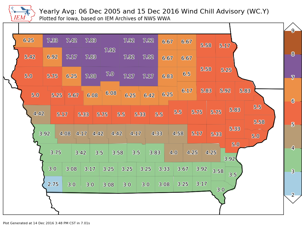
A Wind Chill Advisory is in effect for much of northern Iowa this morning as cold air and
brisk winds are coming to push feels like temperatures well below zero. The featured map
displays the yearly frequency of Wind Chill Advisories by county in the state. The highest
frequencies are shown over the flat areas of north central Iowa with Fremont County in far
southwestern Iowa indicated as the lowest. Why does such a gradient exist over the state?
The coldest air masses arrive in Iowa from the NW and the flat areas over north central
Iowa are the windiest in the state, so this area is favored for the coldest wind chill values.
Also as you go south and when winds are from the NW, these tend to be more chinook
influenced, which means the air is warmer due to down-sloping from the Rocky Mountains.
Voting:
Good = 14
Bad = 1
Tags: windchill
Voting:
Good = 14
Bad = 1
Tags: windchill