IEM Daily Feature
Thursday, 22 January 2009
Thursday, 22 January 2009
Can tell where the snow is
Posted: 22 Jan 2009 06:12 AM
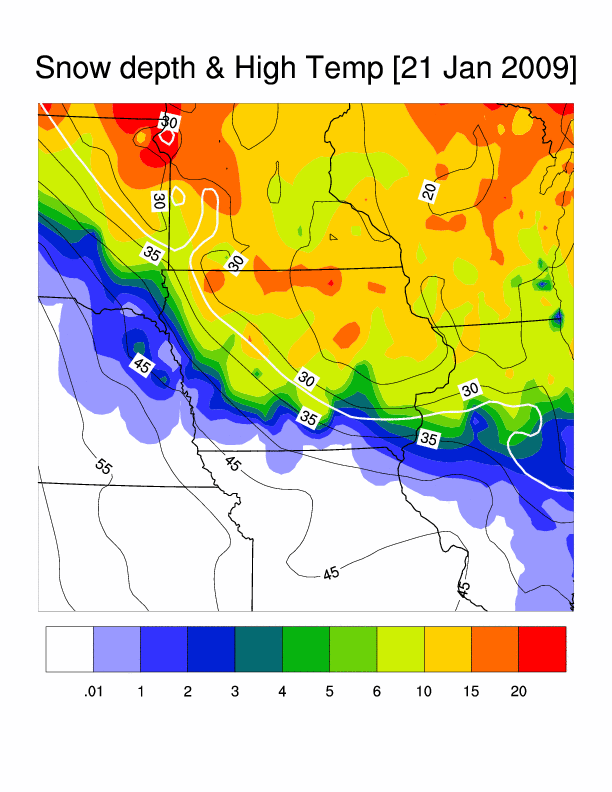
The featured map is an analysis of reported snow depth and high temperature on Wednesday. The 32 degree isotherm nicely lines up with the boundary between deep snowpack and bare ground. It will be interesting to see how far into the snow field the warmer air can get today. Deep snow pack tends to create a very shallow layer of cold air that is difficult to mix warm air into or scour out.
Voting:
Good = 24
Bad = 6
Tags: snowcover
Voting:
Good = 24
Bad = 6
Tags: snowcover